

Zebra Crossing Detection from Aerial Imagery Across Countries
-
Author:
D. Koester, B. Lunt, R. Stiefelhagen
-
Source:
International Conference on Computers Helping People with Special Needs (ICCHP), Linz, Austria, July 2016 (pdf|bib)
- Date: 2016/07
-
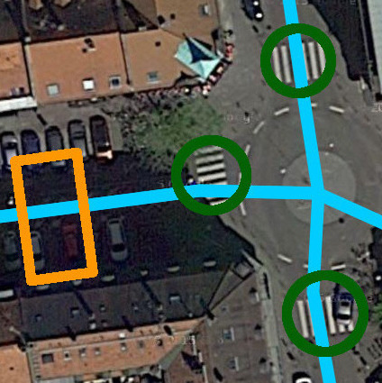 Abstract
We propose a data driven approach to detect zebra crossings in aerial imagery. The system automatically learns an appearance model from available geospatial data for an examined region. HOG as well as LBPH features, in combination with a SVM, yield state of the art detection results on different datasets. We also use this classifier across datasets obtained from different countries, to facilitate detections without requiring any additional geospatial data for that specific region. The approach is capable of searching for further, yet uncharted, zebra crossings in the data. Information gained from this work can be used to generate new zebra crossing databases or improve existing ones, which are especially useful in navigational assistance systems for visually impaired people. We show the usefulness of the proposed approach and plan to use this research as part of a larger guidance system.